Forecasting Streamflow of Brahmaputra River Basin Utilizing Multi-Group Data in SWAT Model
H. M. Rasel, Md. Maruf Hasan, Rana Sarker, ABM Shafkat Hossain, Md. Sohel Rana
Abstract
The Ganges, the Brahmaputra, and the Meghna streams (GBM), along with dividends and feeders, have deposited silt in Bangladesh, forming a delta-shaped floodplain. The Brahmaputra, which originates in Bhutan, China, and India, carries the largest annual flow (about 67 percent) to Bangladesh. Setting up a hydrological model across the Brahmaputra basin is essential for evaluating water accessibility and anticipating inundations in Bangladesh. For this examination, Smack model has been utilized in the absurd basin. The model was aligned and approved utilizing from noticed everyday stream information at Bahadurabad from range of 1998 to 2012. Precipitation information from three grid-based model worldwide standard information items, to be specific, TRMM, APHRDOTIE, and GPCP, have been utilized to reenact the model. After calibrating the model, it was revealed that TRMM information is more accurate than APHRODITE; also, GPCP SWAT was already recreated for the model's arid, moist, and severe troupes in 2035, 2030 and 2025. This has been established as the era progresses, the percentage of rainfall stream will increase to 2-13%, while the pre-storm stream will increase to 21-89%. Also, the rainfall stream is in increasing pattern instead of the measure of post rain stream, which is extremely dangerous. The study demonstrated the most appropriate climate variables for predicting stream flow using the sophisticated SWAT model.
Conclusion
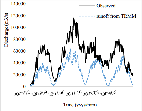
Brahmaputra basin is inadequately measured or checked as there are numerous watersheds. The data for stream flow is not available. In this investigation, distinctive satellite-based gridded precipitation information items were used as a precipitation source. Various boundaries of the overseeing conditions of the design are changed and tweaked to align. SWAT executed watershed recreations sensibly well using numerous wellsprings of rainwater with defining techniques, according to the findings of the inquiry. The re-enactment execution of SWAT is considerably better when using TRMM information, according to direct observation from unit hydrograph and factual markers. The exactness of rainfall input decides the Precisions of model outcomes. Hence, there are now a few challenges to anticipate the top stream in the inundation year. After adjustment and acceptance, the SWAT model was re-enacted by confining the seventh outfit of the ArcSWAT model throughout the early period (2010-2025), mid-period (2015-2030) end-period (2020-2035). The early period estimate of the month-to-month stream arrangement for May, June, and July has been discovered to be expanded by 12 percent, 13 percent, and 9 percent, respectively, from the forecast for the 2025s, and may be expanded by 9 percent, 13 percent, and 14 percent, separately, from the forecast for the 2030s.
The majority of the model agrees that the potential of month-to-month stream progress for August and September might be increased by 5 percent in the 2025s, 8 Percent in the 2030s and 12 percent in the 2035s. The end period estimation of October, November, and December month to month stream arrangement has been determined to be increased by percent, and may be increased by 1 percent, 2 percent, and 4 percent separately for the 2025s, 2030s and 11 percent separately for the 2035s. Therefore, the main finding from the work can be said that, during that moment of predictions, the measure of rainfall stream will be an increment pattern instead of the measure of post rain stream, which is extremely dangerous for our nation. The sensitivity to pre-storm streams remains high till the end of the century. The degree of assurance for a growing storm stream, on the other hand, is far higher.
References
[1]
Arnold, J,G, Srinivasan, R., Muttiah, R.S., Williams, J.R. (1998), Large area hydrologic modeling and assessment part I: model development.J.A.W.R.A., Vol. 34(1), pp. 73–89.
[2]
Bergström, S. (1995) The HBV model. In Singh V.P. (ed.) Computer Models in Watershed Hydrology. Water Resources Publications, Highland Ranch, CO, pp. 443-476. ISBN 0-918334-91-8.
[3]
Bhaskaran, <em>B. "The reversing roles of local and remote circulations on the Indian summer monsoon under a warming scenario." Journal of Geophysical Research 117 (D5)</em>, (2012).
[4]
Chien, H., Yeh, P. J. F., &Knouft, J. H. (2013), <em>Modeling the potential impacts of climate change on streamflow in agricultural watersheds of the Midwestern United States. Journal of Hydrology</em>, Vol. 491, pp. 73-88.
[5]
Chowdhury, M.D., and Ward, <em>N. (2004). Hydro meteorological variability in the greater Ganges–Brahmaputra–Meghna basins. International Journal of Climatology</em>, 24(12), 1495-1508.
[6]
Chowdhury, J.U., Haque, A., Datta, A.R., and Hassan, A., Impact of Climate Change on Surface Water Flow in Bangladesh, Institute of Water and Flood management, BUET, Dhaka, Tech. Rep. Classic, February 2008.
[7]
Cibin, R, Sudheer, K.P., Chaubey, I. (2010). Sensitivity and identifiability of stream flow generation parameters of the SWAT model. Hydrological Processes 24(9): 1133–1148.
[8]
Collins, M., Booth, B. B. B., Bhaskaran, B., Harris, G. R., Murphy, J. M., Sexton, D. M. H. and Webb, M. J. (2011), Climate model errors, feedbacks and forcings: A comparison of perturbed physics and multimodal ensembles, Clim. Dyn. 36, 1737–1766.
[9]
Dhar, O. N., and Nandargi, <em>S. (2000). A study of floods in the Brahmaputra basin in India.International journal of climatology</em>, Vol. 20(7), pp. 771-781.
[10]
Escurra, J. J., Vazquez, V., Cestti, R., De Nys, E., & Srinivasan, R., (2002). Climate change impact on countrywide water balance in Bolivia. Regional Environmental Change, Vol. 534, pp. 1-16.
[11]
FAO (1976) A framework for land evaluation, F.A.O., Roma.
[12]
Ficklin, D. L., Stewart, I. T., and Maurer, E. P., (2013). "Climate Change Impacts on Streamflow and Subbasin-Scale Hydrology in the Upper Colorado River Basin". PloS one, Vol. 8(8), e 71297.
[13]
Gain, A. K., and Wada, Y. (2014), Assessment of Future Water Scarcity at Different Spatial and Temporal Scales of the Brahmaputra River Basin. Water Resources Management, pp.1-14.
[14]
Gassman, P.W., Reyes, M.R., Green, C.H., Arnold, J.G. (2007), The soil and water assessment tool: historical development applications and future research directions. Trans A.S.A.B.E. Vol. 50(4) pp. 1211–125.
[15]
Ghosh, S., and Dutta, <em>S. (2012). Impact of climate change on flood characteristics in Brahmaputra basin using a macro-scale distributed hydrological Model. Journal of earth system science</em>, 121(3), 637-657.
[16]
Gupta, S. K., and Deshpande, R. D. (2004), <em>Water for India in 2050: first-order assessment of available options. Current Science</em>, Vol. 86(9), pp. 1216-1224.
[17]
I.P.C.C., Climate change Synthesis report contribution of working groups I, II and III to the fourth assessment report of the Inter-governmental panel on climate change, Geneva, (2007).
[18]
Immerzeel, <em>W. (2008). Historical trends and future predictions of climate variability in the Brahmaputra basin. International Journal of Climatology</em>, Vol. 28(2), pp.243254, (2008).
[19]
Immerzeel, W. W., Gain, A. K., Sperna-Weiland, F. C., and Bierkens, M. F. P., <em>Impact of climate change on the stream flow of lower Brahmaputra: trends in high and low flows based on discharge-weighted ensemble modeling. Hydrology and Earth System Sciences Discussions</em>, Vol. 8(1), pp. 365-390, (2011).
[20]
Immerzeel, W. W., van Beek, L. P., &Bierkens, <em>M. F. Climate change will affect the Asian water towers. Science</em>, Vol. 328(5984), pp. 1382-1385, (2010).
[21]
Jha M.K. (2011), Evaluation Hydrologic response of agricultural watershed for watershed Analysis. Water, Vol. 3, pp. 604-617, (2011).
[22]
Kankam-Yeboah, K., Obuobie, E., Amisigo, B., &Opoku-Ankomah, Y., <em>Impact of climate change on streamflow in selected river basins in Ghana. Hydrological Sciences Journal</em>, Vol.58 (4), pp. 773-788, (2013).
[23]
Mirza, M.M.Q., Warrick, R.A., Ericksen, N.J. (2003) The implications of climate change on floods of the Ganges, Brahmaputra and Meghna rivers in Bangladesh. Climate Change 57(3):287–318.
[24]
Mirza, M. M. Q. (2011). Climate change, flooding in South Asia and implications. Regional Environmental Change, 11(1), 95-107.
[25]
Mirza, M. Q., Warrick, R. A., Ericksen, N. J., & Kenny, G. J. (1998). Trends and persistence in precipitation in the Ganges, <em>Brahmaputra and Meghna river basins. Hydrological Sciences Journal</em>, 43(6), 845-858.
[26]
Moriasi, D.N., Arnold, J.G., Van Liew, M.W., Bingner, R.L., Harmel, R.D., Veith, T.L. (2002), <em>model evaluation guidelines for systematic quantification of accuracy in watershed simulations</em>, American Society of Agricultural and Biological Engineers, Vol 50(3), 885-900.
[27]
Mousavi, Ashraf Vaghefi, S., S. J., Abbaspour, K. C., Srinivasan, R., and Yang, H., (2013). Analyses of the impact of climate change on water resources components, drought and wheat yield in semiarid regions: Karkheh River Basin in Iran. Hydrological Processes, DOI
https://doi.org/10.1002/hyp.974
[28]
Murphy, J. M., D. M. H. Sexton, D. N. Barnett, G. S. Jones, M. J. Webb,M. Collins, and D. A. Stainforth (2004), Quantification of modelling uncertainties in a large ensemble of climate change simulations,Nature,430, 768–772.
[29]
Narsimlu, B., Gosain, A. K., and Chahar, B. R. (2013), Assessment of Future Climate Change Impacts on Water Resources of Upper Sind River Basin, India Using SWAT Model. Water resources management, Vol.27 (10), pp. 3647-3662.
[30]
Neitsch, S.L., J.G. Arnold; J.R. Kiniry, J.R. Williams and K.W. King. (2002). Soil and Water Assessment Tool Theoretical Documentation, Version 2000. Grassland, <em>Soil and Water Research Laboratory</em>, Temple, <em>TX and Blackland Research Center</em>, Temple, TX.
[31]
Neupane, R. P., Yao, J., & White, J. D, (2013). Estimating the effects of climate change on the intensification of monsoonal driven stream discharge in a Himalayan watershed. Hydrological Processes, DOI
https://doi.org/10.1002/hyp.10115
[32]
Nishat A, <em>Faisal I.M. (2010). An assessment of the Institutional Mechanism for Water Negotiations in the Ganges–the Brahmaputra–Meghna system. International Negotiations</em>, 289–310.
[33]
Perazzoli, M., Pinheiro, A., and Kaufmann, V., <em>Assessing the impact of climate change scenarios on water resources in southern Brazil. Hydrological Sciences Journal</em>, Vol. 58(1), pp. 77-87, (2013).
[34]
Rosenthal, W. D., R. Srinivasan, and J. G. Arnold., Alternative river management using a linked GIS-hydrology model, Transactions of the A.S.A.E., Vol. 38 (3) pp. 783, (1995).
[35]
Saha, P. P., Zeleke, K., & Hafeez, M. (2011), <em>Streamflow modeling in a fluctuant climate using SWAT: Yass River catchment in south eastern Australia. Environmental Earth Sciences</em>, pp.1-14.
[36]
Salehin, M., Chowdhury, J.U., and Islam, A.K.M.S. (2011), Development of a water resources model as a decision support tool for national water management, Tech. Report, Institute of water and flood management, BUET.
[37]
Srinivasan, R., and J. G. Arnold., Integration of a basin-scale water quality model with G.I.S.”.Water Resour. Bull. Vol. 30 (3) pp. 453-462, (1994).
[38]
Tripathi, M. P., R. K. Panda and Raghuwanshi, N. S. (2003). Identification and Prioritization of critical sub-watersheds for soil conservation management using SWAT model, <em>Biosystems Engineering</em>, 85(3): pp 365-379.
[39]
USACE, 2001. Hydrologic Modelling System HEC HMS Technical Reference Manual. Maret 2000.
[40]
Zahabiyoun, B., Goodarzi, M.R., Bavani, A.R.M and Azamathulla, H. M. (2011), Assessment of Climate Change Impact on the Gharesou River Basin Using SWAT Hydrological Model, CLEAN, soil Air water
https://doi.org/10.1002/clen.201100652